Projects
Miami Circle - Learn More - Archaeological Projects, Investigation 5
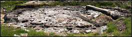
Archaeologists from Panamerican Consultants, Inc., working with the Archaeological and Historical Conservancy, made a map of the cut basins and holes of the Miami Circle feature. Along with the major basins and holes that form the Miami Circle a total of 870 cut features in the limestone were mapped.
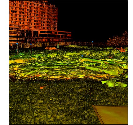
Archaeologists from the University of South Florida (USF) and surveyors from Geomatic Services division of Phillips & Jordan, Inc. joined the mapping team and used a high-tech computer to create 3-dimensional laser scans of the Miami Circle. This method was the most efficient way to document the extremely complex features uncovered at the site. Laser scans were made from different positions around the Miami Circle and from an overhead crane. Reflective targets visible in the scans were used to tie the images to known geographic points.
USF archaeologists Brent Weisman and Lori Collins explain that the "cloud" of points that make up the scans are so dense that the image looks like a photograph. Based on the data collected GIS software was used to create a detailed contour map 3-D model of the Miami Circle.